Definition of Democratizing GIS Data: Democratizing GIS data refers to making geographic information system (GIS) tools and data accessible and usable by all members of an organization, regardless of their technical expertise.
Importance of Democratizing GIS Data for Organizations: Democratizing GIS data is crucial for organizations as it allows for informed decision-making, enhanced collaboration, and improved operational efficiencies across all departments.
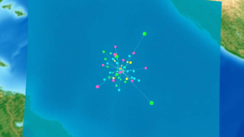
Overview of Mira Spatial and Its Mission: Mira Spatial is a technology company that focuses on transforming infrastructure monitoring and analytics using cutting-edge tools such as drones, satellites, and AI. Their mission is to revolutionize infrastructure management by leveraging reality capture technology and advanced analytics to drive actionable insights for industries like energy, construction, and local governments.
Key Aspects of Democratizing GIS Data
1. Broad Access
Democratizing GIS data starts with broad access—extending GIS tools beyond traditional specialists to every user within your organization. This shift breaks down barriers that often limit spatial data analysis to expert GIS professionals. When you enable non-specialists to interact with geographic information, you unlock new perspectives and foster innovation across departments.
Making GIS tools accessible to non-specialists means designing solutions that are intuitive and easy to navigate. Complex interfaces and technical jargon create friction, discouraging users who lack formal GIS training. User-friendly applications address this challenge by simplifying workflows, offering guided experiences, and presenting data visually in ways that anyone can understand.
The benefits of such applications include:
- Faster adoption rates as users feel confident engaging with the software
- Increased data utilization because more employees can explore spatial insights independently
- Reduced bottlenecks on GIS teams, allowing them to focus on advanced analyses and strategy rather than routine requests
Minimal training requirements play a critical role in achieving widespread adoption. Training programs that demand extensive time or specialized knowledge deter casual users and slow down organizational momentum toward democratization. Instead, platforms designed for simplicity allow users to start analyzing data almost immediately—empowering them to ask questions, test hypotheses, and make decisions based on spatial information without waiting for support.
Mira Spatial embodies this approach by delivering end-to-end solutions with an emphasis on accessibility. Its suite of tools integrates real-time monitoring, AI-driven analytics, and high-precision mapping into interfaces tailored for diverse users—from field technicians inspecting assets to executives assessing risk. This design philosophy ensures that GIS capabilities are embedded naturally into daily workflows rather than confined to niche teams.
By focusing on broad access through user-friendly applications and minimal training, organizations position themselves to leverage the full potential of their geospatial data—transforming it from a specialized resource into a shared asset that drives informed decision-making at every level.
2. Empowering Decision-Making
A crucial aspect of democratizing GIS data is its ability to empower decision-making across all levels of an organization. When employees have direct access to geospatial data, they can make informed decisions based on real-time information rather than relying solely on the insights provided by specialized teams. This shift not only speeds up the decision-making process but also enhances the quality of decisions made.
For instance, field technicians equipped with user-friendly GIS tools can quickly assess asset conditions and make immediate recommendations without having to wait for a detailed report from a GIS analyst. Similarly, executives can visualize risk assessments in real-time during strategic meetings, leading to more effective planning and resource allocation.
This empowerment is further amplified when organizations adopt a culture of data literacy where employees are encouraged to explore and analyze data independently. Providing resources such as online tutorials or interactive workshops can help cultivate this culture, enabling employees to leverage geospatial data effectively in their roles.
In conclusion, democratizing GIS data is not just about broadening access or simplifying tools—it’s about fundamentally changing how an organization interacts with its geospatial data. By prioritizing accessibility and user-friendliness while fostering a culture of data literacy, organizations can transform their geospatial data from a specialized resource into a shared asset that drives informed decision-making at every level
2. Collaboration and Sharing
Democratizing GIS data goes beyond broad access; it requires tools that foster collaboration and sharing across your entire organization. Extending GIS capabilities through interactive features and easy sharing options transforms how teams work together on spatial projects.
Key elements include:
- Interactive Features: Tools like real-time map editing, annotation, and commenting enable users to engage directly with spatial data. These features turn static maps into dynamic workspaces where insights emerge through collective input.
- Easy Sharing Capabilities: User-friendly applications allow seamless distribution of maps, reports, and analytics without technical barriers. Sharing happens across departments or even with external partners, ensuring everyone stays aligned with up-to-date information.
- Encouraging Data-Driven Decisions: Collaboration tools promote transparency and inclusivity in decision-making. When stakeholders can visualize spatial data together, they make informed choices rooted in accurate geographic context.
- Facilitating Teamwork on Spatial Projects: Shared platforms break down silos between GIS specialists and other team members. Cross-functional groups—such as operations, engineering, and management—can coordinate efforts efficiently using common geospatial resources.
A collaborative environment built on these principles supports the core mission of democratizing GIS data: making spatial intelligence accessible, actionable, and integrated into daily workflows. This section complements previous discussions on broad access, highlighting how interactive sharing elevates the value of extending GIS tools across your organization.
3. Cloud and Open Standards
Cloud-native solutions play a crucial role in making GIS data available to everyone by providing infrastructure that is scalable, flexible, and accessible. Unlike traditional on-premises GIS systems, cloud platforms eliminate the limitations of physical hardware and complex installations. With cloud solutions, you can:
- Access GIS data anytime, anywhere, supporting remote work and field operations.
- Scale storage and processing power dynamically based on demand.
- Reduce IT overhead by outsourcing maintenance, updates, and security to cloud providers.
Cloud-native architectures also enable seamless integration with other enterprise systems through APIs, enhancing collaboration and data sharing across departments.
Open standards are essential for effectively democratizing GIS data. They ensure that different software tools, data formats, and platforms can work together. The significance of open standards in geospatial data includes:
- Facilitating data exchange without vendor lock-in.
- Supporting a wide range of applications from visualization to advanced spatial analytics.
- Promoting transparency and consistency in how spatial data is represented and used.
Standards such as OGC (Open Geospatial Consortium) protocols—WMS (Web Map Service), WFS (Web Feature Service), and GeoJSON—are widely adopted for their ability to unify diverse GIS ecosystems. When your organization embraces open standards alongside cloud-native solutions, you create an environment where GIS tools extend naturally beyond specialists. This fosters broad access through user-friendly applications that require minimal training while encouraging collaboration and self-service analytics.
Each key aspect of democratizing GIS data—Broad Access, Collaboration and Sharing, Cloud and Open Standards, Self-Service Analytics—contributes uniquely to transforming how your organization leverages spatial intelligence at scale.
4. Self-Service Analytics
Empowering users with self-service analytics tools is crucial in democratizing GIS data. By providing access to these tools, organizations can reduce their reliance on specialized teams for basic queries.
Self-service analytics models allow users to navigate and analyze spatial data independently. This empowers employees across different departments to extract insights and make data-driven decisions without needing specialized GIS expertise. Through intuitive interfaces and interactive features, such as drag-and-drop functionalities and pre-built templates, users can explore geospatial information effortlessly.
Benefits of Self-Service Analytics:
- Increased Efficiency: Users can generate customized reports and visualizations without waiting for dedicated GIS professionals.
- Enhanced Decision-Making: Rapid access to spatial insights enables quicker responses to changing conditions or emerging trends.
- Cost Savings: Organizations can optimize resources by distributing analytical tasks among a broader base of employees.
By extending GIS tools through self-service analytics capabilities, organizations foster a culture of data-driven decision-making at all levels. This approach not only streamlines operations but also encourages innovation and collaboration across teams.
5. Use Cases and Benefits
Introducing the key aspects that contribute to successful GIS data democratization within organizations sets the stage for exploring real-world applications. Each aspect plays a vital role in reshaping how data is accessed and utilized across various industries.
Examples of Organizations Benefiting from Democratized GIS Data
- Public Transportation Agencies: By democratizing GIS data, public transportation agencies can optimize routes, improve scheduling, and enhance passenger experiences. Real-time tracking and predictive analytics enable better decision-making to streamline operations and increase efficiency.
- Retail Chains: Retail companies leverage democratized GIS data to analyze foot traffic, optimize store locations, and personalize marketing strategies based on spatial insights. Understanding customer behavior through geospatial analysis leads to targeted campaigns and improved sales performance.
Improvements in Operations and Customer Experiences
- Enhanced Efficiency: Democratized GIS data empowers organizations to make informed decisions quickly, reducing operational bottlenecks and streamlining processes.
- Customer-Centric Approach: Access to spatial insights allows businesses to tailor their services based on geographic trends and customer preferences, leading to enhanced customer satisfaction and loyalty.
By implementing user-friendly applications with minimal training requirements, organizations can unlock the full potential of GIS data across diverse sectors, driving innovation and sustainable growth.
6. Challenges Addressed
Introducing the key aspects contributing to successful GIS data democratization within organizations sets the stage for understanding the challenges addressed. Each aspect plays a vital role in overcoming barriers and driving adoption.
Overcoming Barriers
- Complex Software Requirements: Many GIS tools have traditionally been complex, requiring specialized training and skills to operate effectively. This complexity often acts as a barrier to broader access within organizations.
Skill Gaps
- Addressing Challenges: Organizations face significant challenges related to skill gaps in GIS expertise. Limited access to specialists can hinder the democratization of GIS data across departments.
In addressing these challenges, organizations must focus on simplifying tools, providing adequate training, and fostering a culture of data literacy to enable widespread adoption and utilization of GIS data.
Transformative Impact of Democratizing GIS Data
Embedding spatial intelligence in workflows shifts how organizations operate daily. When GIS data is accessible across departments, teams start to think spatially without needing specialized skills. This integration transforms routine tasks into opportunities for deeper insights.
1. Decision-making becomes faster and more informed
When spatial data is embedded directly into your business processes, you can visualize patterns and relationships that were previously hidden. For example, a utility company can instantly identify outage locations and their causes by overlaying asset conditions with real-time weather data. This reduces downtime and accelerates response times.
2. Cross-functional collaboration improves
With shared access to spatial insights, different teams—engineering, operations, customer service—align their objectives based on the same geographic context. This unified view fosters proactive problem-solving rather than reactive firefighting.
3. Operational agility increases
Organizations adapt more swiftly to changes because they leverage spatial analytics to anticipate risks or optimize resource allocation. If a construction project encounters unexpected site conditions, teams equipped with GIS data can rapidly adjust plans by visualizing alternatives on a map.
4. Examples of impact in various sectors:
Renewable energy firms use spatial intelligence to maximize asset performance by monitoring environmental factors alongside equipment status.
Local governments improve public services by mapping infrastructure needs against demographic trends for targeted investments.
AEC companies streamline project management with geospatial dashboards that track progress and potential delays in real time.
Embedding spatial intelligence into daily workflows breaks down silos and creates an environment where location-based insights are part of every decision you make. This cultural shift enhances not only efficiency but also innovation across the entire organization.
Conclusion
Making GIS data available to everyone in your organization can transform business operations. It breaks down traditional barriers and allows spatial intelligence to be used at all levels. By taking a comprehensive approach, you can integrate user-friendly technologies like Mira Spatial’s platforms, which combine reality capture, AI analytics, and cloud-native solutions to empower all users.
Here are the key things to focus on:
- Use advanced technology that simplifies complex GIS data without losing depth or accuracy.
- Create a culture of data-driven decision-making, promoting collaboration and shared insights across departments.
- Provide ongoing support and maintenance to ensure systems remain flexible and aligned with the changing needs of the organization.
This combination ensures that making GIS accessible to everyone is not just a one-time project, but rather a sustainable and evolving capability. It continuously improves agility, insight, and operational excellence.
FAQs (Frequently Asked Questions)
What does democratizing GIS data mean for an organization?
Democratizing GIS data means making geographic information system tools and data accessible to everyone within an organization, including non-specialists. It involves enabling broad access, fostering collaboration, and providing user-friendly applications that require minimal training, thereby empowering all employees to leverage spatial data in their workflows.
Why is broad access important in democratizing GIS data?
Broad access ensures that GIS tools are available to non-specialists across the organization. This accessibility through user-friendly applications and minimal training promotes widespread adoption, allowing more team members to engage with spatial data effectively and make informed decisions.
How do cloud-native solutions and open standards support GIS data democratization?
Cloud-native solutions provide scalable, accessible platforms for storing and analyzing GIS data, while open standards ensure interoperability and easy sharing of geospatial information. Together, they enable seamless collaboration across departments and external partners, enhancing the organization’s ability to utilize spatial intelligence efficiently.
What role does self-service analytics play in democratizing GIS data?
Self-service analytics empowers users to independently explore and analyze GIS data without relying on specialized teams. This reduces bottlenecks, accelerates decision-making processes, and fosters a culture of data-driven insights by enabling users at all levels to perform basic queries and generate meaningful spatial analyses.
Can you provide examples of organizations benefiting from democratized GIS data?
Organizations such as public transportation agencies and retail chains have benefited from democratized GIS data by improving operational efficiency and enhancing customer experiences. By enabling broader access to spatial information, these organizations can optimize routes, target marketing efforts, and respond swiftly to changing conditions.
What challenges does democratizing GIS data address within organizations?
Democratizing GIS data helps overcome challenges like complex software requirements and skill gaps that traditionally limit access to geospatial tools. By providing user-friendly applications, fostering collaboration, and leveraging cloud technologies, organizations can break down barriers to effective use of spatial data across diverse teams.