Introduction
Asset inspection has evolved significantly, with various methods employed to ensure infrastructure integrity. Traditional techniques often rely on manual inspections, which can be time-consuming and prone to human error. The integration of technology into inspections is essential for enhancing efficiency and accuracy.
Key benefits of integrating drone and satellite imagery into your asset inspection:
- Increased efficiency: Drones expedite the inspection process, capturing data quickly.
- High-resolution imagery: Advanced sensors provide detailed visual assessments.
- Safety improvements: Reducing personnel exposure in hazardous environments.
Mira Spatial stands at the forefront of this technological transformation. As a leading technology company, it focuses on revolutionizing infrastructure monitoring through innovative solutions that leverage drones, satellites, and artificial intelligence. Mira Spatial’s mission is to enhance infrastructure management by providing actionable insights and comprehensive analytics. Their offerings include:
- Infrastructure Monitoring & Analytics: Real-time asset tracking and predictive maintenance.
- Asset Intelligence Platform: AI anomaly detection and interactive dashboards.
- Reality Capture Services: High-precision mapping through drone and satellite data acquisition.
Through these services, Mira Spatial aims to deliver cutting-edge technology paired with industry expertise, setting new standards in asset inspection practices.
The Need for Modern Asset Inspection Techniques
1. Efficiency and Speed
The world of asset inspection is changing quickly, mainly because there’s a growing demand for faster and more efficient ways to monitor infrastructure. Traditional methods of inspection usually involve manual processes that can take a lot of time and effort. These limitations can result in delays in assessments, which may lead to higher risks and increased maintenance expenses.
Drones have emerged as a game-changing solution in this situation. They have the capability to cover large areas quickly, which allows for:
- Faster inspections: Drones can conduct inspections in a fraction of the time it takes traditional methods, enabling real-time data collection.
- Reduced manpower needs: With drones handling much of the workload, teams can focus on analysis rather than on-site inspections.
When comparing drone inspections with traditional methods, several advantages become evident:
- Speed: Drones can inspect vast terrains—such as wind farms or transmission lines—in a matter of hours, while traditional teams might take days.
- Accessibility: Drones reach hard-to-access areas without the need for scaffolding or ladders, ensuring comprehensive coverage without compromising safety.
- Data accuracy: Drones capture high-resolution imagery that enhances data quality for detailed assessments, further streamlining decision-making processes.
Integrating drones into your asset inspection strategy not only accelerates operations but also elevates the overall effectiveness of your infrastructure monitoring practices. The immediate benefits are clear, yet the long-term implications promise even greater enhancements in efficiency and reliability.
2. High-Resolution Data Collection
Drones equipped with advanced sensors are changing the game in data collection for asset inspections. Here are the main types of sensors used:
- Cameras: Capture high-resolution images for detailed visual assessments.
- Thermal Sensors: Identify heat anomalies, critical for detecting issues in electrical infrastructure.
- Lidar: Provides precise 3D mapping, enhancing spatial analysis.
Traditional methods often struggle with limitations such as human error and time constraints, increasing risks associated with manual inspections. The need for technological advancements in infrastructure management becomes clear when we consider the benefits of using drone and satellite imagery in your asset inspection processes. Detailed images support accurate condition assessments, enabling proactive maintenance and better decision-making.
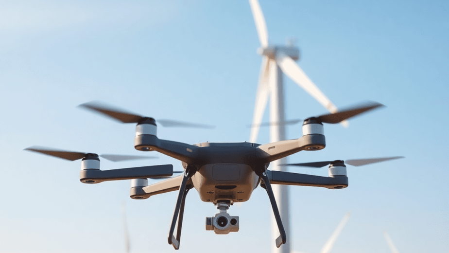
3. Access to Difficult Areas
Challenging assets often present significant obstacles for traditional inspection methods. Examples include:
- Bridges: Inspecting structural integrity can involve complex setups and manual assessments.
- Wind Turbines: Height and remote locations complicate access, increasing safety risks.
Drones effectively address these limitations by providing:
- Real-time data collection: Quickly gathering necessary information without hazardous climbs or setups.
- Safety enhancements: Reducing personnel exposure to dangerous conditions associated with manual inspections.
The need for technological advancements in infrastructure management is clear. Drones enable faster inspections in hard-to-reach locations, streamlining the process while maintaining a focus on safety.
4. Cost-Effectiveness
Using drones for asset inspections can save you money compared to traditional methods. Here’s how:
1. Reduced Operational Costs
Drones require less manpower, which means you’ll save on labor costs.
2. Faster Inspections
With drones, you can collect data in real-time and complete inspections more quickly. This allows for faster decision-making.
3. Limitations of Traditional Methods
Manual inspections often face challenges such as weather delays and safety risks. These issues can lead to increased downtime and costs.
4. Long-Term Benefits
Investing in drone technology not only improves your current inspections but also helps you save on maintenance expenses by proactively monitoring your infrastructure.
Embracing this technological advancement is crucial for efficient asset management.
5. Safety Improvements
Integrating drone and satellite imagery significantly enhances safety during asset inspections. The limitations of traditional methods expose workers to hazardous environments, increasing the risk of accidents. By utilizing drones for real-time data collection, companies can achieve:
- Reduction in personnel exposure to danger: Drones access hard-to-reach areas without putting workers at risk.
- Enhanced safety protocols through technology integration: Real-time insights lead to better decision-making, minimizing potential hazards.
The need for technological advancements in infrastructure monitoring is clear as drones provide faster inspections while effectively addressing the challenges faced by manual inspections.
Complementary Role of Satellite Imagery
Integrating drone data with satellite imagery offers distinct advantages for asset monitoring. The combination allows for global-scale monitoring, ensuring comprehensive coverage of large areas that drones alone might struggle to assess effectively.
Key benefits include:
- Enhanced Data Completeness: Satellite imagery provides a broad perspective, capturing large landscapes and identifying potential issues that ground-level drone surveys may miss.
- Multi-Layered Insights: Merging high-resolution drone data with satellite images creates detailed, layered models of asset conditions, allowing for more informed decision-making.
- Timely Updates: Satellite technology can continuously monitor changes in asset health over time, providing critical insights into trends and potential risks.
This integration transforms how organizations approach asset management, fostering proactive strategies that enhance overall asset health monitoring and longevity.
Broader Perspective on Asset Health
Satellite technology offers significant advantages in large area assessments. The ability to conduct geographical analysis provides a macro-level view of asset conditions that drones alone cannot achieve. Key benefits include:
- Wide Coverage: Satellites can monitor vast regions, identifying potential issues before they escalate.
- Historical Data Comparison: Satellite imagery enables trend analysis over time, helping to track changes in asset health.
Use cases highlight the synergy between drones and satellites:
- Urban Planning: Combining satellite data with drone inspections allows for comprehensive assessments of infrastructure needs within cities.
- Environmental Monitoring: Satellites identify environmental risk factors while drones provide detailed inspections, ensuring informed decision-making.
This integration enhances asset management strategies, enabling stakeholders to respond proactively to emerging challenges.
Advanced Data Management and Analysis
The integration of AI analytics into asset management systems is changing the way data collected from drones and satellites is processed. Here are some key benefits:
1. Enhanced Insights
AI algorithms analyze large datasets quickly, identifying patterns and anomalies that might go unnoticed. This capability allows for proactive maintenance strategies.
2. Real-Time Updates
Continuous data streaming from drones and satellites ensures that you receive up-to-date information. This immediacy supports informed decision-making, enabling rapid responses to emerging issues.
By combining high-resolution imagery with advanced analytics, you gain a comprehensive understanding of asset health. This combination of technology not only improves inspections but also enhances long-term asset management strategies. The use of drone and satellite imagery in your asset inspection processes promotes a smarter, more efficient way to monitor infrastructure.
Regulatory Compliance
Regular inspections are crucial for maintaining safety regulations and ensuring standards adherence across various industries. These inspections are essential for identifying potential issues before they escalate into significant problems, thus safeguarding infrastructure integrity.
Key benefits of adhering to regular inspection protocols include:
- Prolonged Infrastructure Lifespan: Timely assessments help detect wear and tear early, extending the life of critical assets.
- Reduced Maintenance Costs: Preventative measures based on inspection findings can significantly lower long-term maintenance expenses.
Integrating drone and satellite imagery into inspection processes enhances compliance by providing detailed, real-time data. This technology ensures that inspections are thorough and efficient, meeting regulatory requirements while improving asset management practices. The combination of precision and frequency of inspections helps organizations stay ahead of regulatory changes and maintain operational excellence.
Embracing Digitalization in Asset Management
The shift towards digital methods in asset management is changing industry standards. Organizations are increasingly using advanced technologies to streamline operations and improve efficiency. Key aspects include:
- Enhanced Analysis: Using data from drones and satellites for deeper insights into asset conditions, enabling proactive maintenance strategies.
- Machine Learning Training: Implementing AI-driven models to predict potential failures, reducing downtime and enhancing reliability.
Digitalization not only improves current practices but also prepares businesses for future operational needs. As technology advances, asset management will become more data-driven and adaptable, allowing firms to quickly respond to market changes and regulatory requirements. This shift highlights the importance of continuous learning and innovation within the workforce, ensuring that teams have the latest tools and methods. Such progress indicates a bright future for asset management practices.
Future Potential of Drone and Satellite Integration
The integration of drone and satellite technologies in asset management is set to redefine industry standards. Here are key predictions for this evolution:
- Enhanced Operational Efficiency: As AI advancements continue, expect real-time data processing to become the norm, drastically reducing the time needed for inspections.
- Improved Accuracy: The combination of high-resolution imagery from drones and the broad coverage of satellites will lead to unprecedented precision in asset monitoring.
- Predictive Maintenance: Advanced algorithms will facilitate better condition assessments, allowing organizations to anticipate issues before they escalate into costly repairs.
- Scalability: Businesses can leverage this technology across diverse sectors, scaling their asset management strategies without significant increases in overhead costs.
These anticipated improvements position businesses to harness the full potential of integrating drone and satellite imagery into their asset inspection processes.
Conclusion
The benefits of integrating drone and satellite imagery into your asset inspection processes are undeniable. Employing modern inspection techniques not only enhances efficiency but also significantly improves data quality and safety.
Key advantages include:
- Enhanced accuracy through high-resolution imagery.
- Rapid inspections that reduce downtime and costs.
- Access to difficult areas, mitigating risks associated with traditional methods.
By adopting these advanced technologies, organizations can ensure thorough assessments, proactive maintenance, and better decision-making based on real-time data. The integration of drones and satellite imagery supports a comprehensive approach to asset management, ultimately leading to improved infrastructure longevity and reliability.
Consider taking the step towards innovation. Integrating drone and satellite technologies into your asset inspection processes positions your organization at the forefront of modern asset management. Embrace this opportunity to elevate your operations and secure your assets effectively.