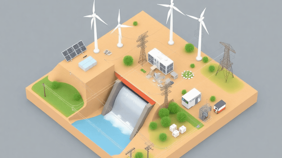
In the field of infrastructure management, there are two main methods that have come up: aerial capture and traditional methods. It’s important to understand these approaches for successful project execution in 2025.
- Aerial Capture uses drone technology, LiDAR systems, and satellite data to provide fast and accurate mapping and monitoring.
- Traditional Methods depend on manual surveys and ground-based inspections, focusing on established techniques for gathering data.
Comparing these two methods helps us understand their strengths and weaknesses. With advancements in technology, such as drones and LiDAR systems, data collection is becoming faster and less prone to human error. As infrastructure projects continue to evolve, it’s crucial to evaluate the advantages and disadvantages of these methods in order to allocate resources effectively and achieve project goals efficiently.
Understanding Aerial Capture
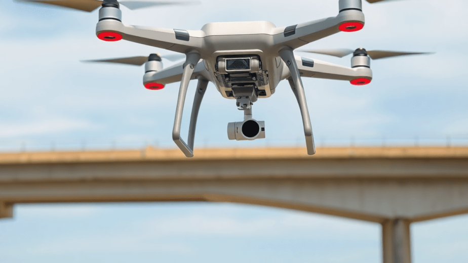
Aerial capture, using drones and advanced sensors, is a game-changing method in fields like agriculture, surveying, and emergency response. This technique involves gathering detailed data from above, using tools such as multispectral sensors to collect vital information for making informed decisions.
Applications of Aerial Capture
1. Agriculture
Drones are used in farming to monitor crops and manage resources efficiently. They help farmers evaluate soil conditions and keep an eye on irrigation systems.
2. Surveying
In construction and civil engineering, aerial capture offers accurate maps and 3D models, making project planning and execution smoother.
3. Emergency Response
During natural disasters, drones play a crucial role by quickly assessing affected areas. This information helps allocate resources effectively for recovery efforts.
Advantages of Using Drones
1. Rapid Data Acquisition
Drones can cover large areas much faster than traditional methods. This speed is crucial for making quick decisions in fast-paced situations.
2. Cost-Effectiveness
Drone operations have lower costs compared to conventional approaches, resulting in overall savings for projects. The reduced need for manpower further enhances financial efficiency.
3. Access to Hard-to-Reach Areas
Drones can fly in difficult terrains where traditional methods may face challenges, ensuring thorough data collection without compromising safety.
Limitations of Aerial Capture
Despite its benefits, aerial capture has some limitations:
- Regulatory Challenges: Following aviation rules can make drone operations complicated, especially in cities or near airports.
- Weather Conditions: Bad weather can affect flight safety and the quality of data collected. Rain, fog, or strong winds may delay projects or require redoing missions.
- Initial Costs: While operational costs are low, the initial investment for advanced drone systems and equipment may be a barrier for some organizations.
Understanding these aspects is crucial for effective planning in infrastructure monitoring projects when considering aerial capture technologies.
Exploring Traditional Methods
Traditional methods in infrastructure monitoring primarily include manual surveys and ground-based inspections. These approaches have been the foundation of data collection for decades, relying on physical presence and direct observation.
Advantages
- High-quality Data Reliability: In certain contexts, such as small-scale projects, traditional methods often yield highly reliable data. Detailed inspections can uncover nuanced issues that automated systems might overlook.
- Established Practices: These methods have a long history, with well-defined protocols ensuring consistency and accuracy in data collection.
Disadvantages
Despite their advantages, traditional methods present several challenges:
- Labor Costs: The need for skilled personnel increases operational expenses significantly. Continuous training is essential to maintain high standards of inspection.
- Time-consuming Processes: Manual surveys often require extensive time to complete, delaying project timelines and decision-making.
- Logistical Challenges: Accessing remote locations or conducting extensive inspections can be cumbersome. Terrain difficulties and weather conditions may hinder operations, leading to inefficiencies.
The reliance on traditional methods serves specific needs but introduces limitations that affect scalability and responsiveness. As infrastructure demands evolve, the integration of emerging technologies into traditional practices becomes increasingly relevant. This evolution paves the way for more efficient methodologies in monitoring infrastructure.
Comparing Technologies: Aerial Capture vs. Traditional Methods
Understanding LiDAR and photogrammetry is essential for grasping their importance in 3D modeling applications. Both technologies use aerial data collection to improve infrastructure monitoring capabilities.
How They Work
- LiDAR (Light Detection and Ranging) uses laser beams to measure distances, creating highly accurate models of the Earth’s surface. This precision makes it suitable for projects needing detailed information in complex environments.
- Photogrammetry, on the other hand, takes pictures from different angles to recreate 3D objects. While effective for visual representations, it may not achieve LiDAR’s accuracy in dense or difficult landscapes.
Why It Matters
These technologies play a vital role in enhancing infrastructure monitoring by providing detailed and precise data. This information is crucial for making informed decisions about maintenance, repairs, and planning future developments.
Comparative Analysis
When comparing these technologies with traditional methods, several factors come into play:
Accuracy
- LiDAR provides superior accuracy, particularly beneficial in infrastructure monitoring where detail is crucial.
- Photogrammetry offers adequate accuracy for less intricate projects but can be influenced by environmental conditions.
Cost-effectiveness
- Aerial capture (LiDAR and photogrammetry) often leads to reduced labor costs and faster data collection timelines compared to manual inspections.
- Initial investments in aerial technologies can be offset by long-term savings through efficient monitoring and predictive maintenance strategies.
The choice between aerial capture and traditional methods depends on project needs, highlighting the significance of technological advancements in shaping future infrastructure solutions.
Case Studies and Real-world Applications
Mira Spatial has successfully implemented aerial capture technologies across various sectors, showcasing the distinct advantages of these modern approaches. Notable projects include:
1. Energy Sector
Utilization of drone technology for real-time inspections of transmission lines. Aerial capture enables rapid data acquisition, identifying anomalies with precision. Traditional methods often relied on manual inspections, which are labor-intensive and time-consuming.
2. Renewable Energy
In wind farm assessments, drones equipped with LiDAR systems provide comprehensive site analyses. This contrasts sharply with previous ground-based surveys that required significant human resources and extensive logistical planning.
3. Infrastructure Monitoring
Projects involving municipal infrastructure have benefited from high-resolution mapping and predictive maintenance enabled by Mira Spatial’s solutions. Traditional inspections typically encountered challenges in accessing remote or hazardous locations.
The integration of these innovative technologies demonstrates a clear shift in how infrastructure monitoring can be approached, enhancing both efficiency and accuracy in data collection. For more information about our projects and the technology we use, please visit our news page or contact us directly.
Future Trends in Infrastructure Monitoring for 2025
As infrastructure monitoring evolves, aerial capture technologies are poised to play a critical role. Predictions for 2025 highlight several key trends:
- Emerging Technologies: Advancements in drone capabilities, including enhanced sensors and AI integration, will facilitate faster and more accurate data collection.
- Automated Solutions: The shift towards automation will streamline processes, reducing the need for manual interventions. Automated drones equipped with smart algorithms can conduct inspections and monitoring tasks with minimal human oversight.
- Operational Efficiency: Enhanced analytical tools will enable real-time data processing, allowing for immediate decision-making. Organizations can expect improved predictive maintenance strategies that minimize downtime and optimize resource allocation.
The integration of these trends signals a significant transformation in how infrastructure is managed, paving the way for more proactive and efficient monitoring strategies in the coming years.
Choosing the Right Vendor Partner
The choice between Aerial Capture vs. Traditional Methods for infrastructure monitoring depends on several factors:
- Project Requirements: Specific needs dictate whether aerial capture or traditional methods are more suitable.
- Data Quality Needs: Some projects may prioritize high-resolution, ground-level data, while others benefit from the rapid scalability of aerial methods.
- Budget Considerations: Cost-effectiveness must align with project goals.
Staying up-to-date with technological advancements is crucial. Companies like Mira Spatial exemplify how innovation in reality capture technology can transform infrastructure management strategies. Their comprehensive solutions offer significant advantages in efficiency and accuracy, vital for meeting future demands in the industry. Embracing these evolving methodologies ensures that stakeholders remain competitive and informed as they navigate the complexities of modern infrastructure projects.